3265 - Kaimanawa's
3265 - Kaimanawa's
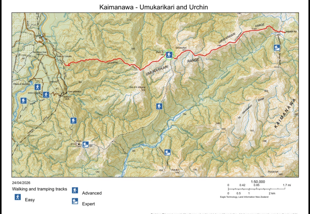
Leave Hamilton on Friday night and will likely camp at one of two nearby DOC campsites, the Urchin Campsite or Waikoko Campsite.
Saturday morning will be an early departure from the road end, with a car at either end or with one car left at the end, and hike the 3km to the track start. The track climbs steadily through beech forest to the treeline, then follows a poled route along the Umukarikari Range, with spectacular views across the Kaimanawa Forest Park, Lake Taupō and the volcanoes. The route passes Sharp Cone (1481 m) and the Umukarikari summit (1561 m) along an open ridge, before dropping into the Waipahiki Valley. The track crosses the Waipakihi River (unbridged), followed by a short track up to Waipakihi Hut (12 bunks). The hut is popular but camping is available nearby. ( est. 6 - 8 hours)
On Sunday, either return the same way to Umukarikari summit, then take the long open ridgeline on the left leading to the Urchin Trig. Alternatively, follow the Waipakihi River, if conditions allow for approx 10km, to find a track that climbs steeply through the bush to the ridgeline and onto Urchin Trig. From here the track descends steeply through the bush to the road end. This could be a long day, est. 8 - 10 hours, plus the drive home.
| Leader: | Miles Rowe | Phone: | 0272762532 | |
| Grade: | M/F | Email: | ||
| Transport (van): | TBD | |||
Event Information
| Event Date | Fri 30th Oct 2026 |
| Event End Date | Mon 2nd Nov 2026 |
| Capacity | Unlimited |
| Registered | 0 |